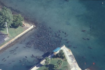
Aerial Surveys
Aerial surveys document
habitat
use
patterns, seasonal distribution,
and
relative abundance of manatees.
Mote Marine Laboratory has been
conducting aerial surveys since
1985.
Manatee research staff currently
survey Sarasota County and
Charlotte
Harbor year round. Dr.
Reynolds
has
been flying winter surveys of
Florida
Power & Light power plants
around
the state since the 1980s.
Photographic Identification 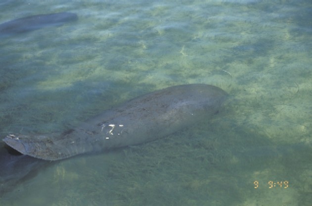
Many Florida manatees have
scars
and mutilations from boat
strikes.
Scientists use these markings to
identify
individual manatees. Mote
Marine
Laboratory staff have worked
closely
for
years with scientists at the US
Geological
Survey and the Florida Fish and
Wildlife
Conservation Commission to
collect
high
quality photographs of
recognizable
individual manatees. These
photographs
are useful for the assessment of
the
status of regional
subpopulations.
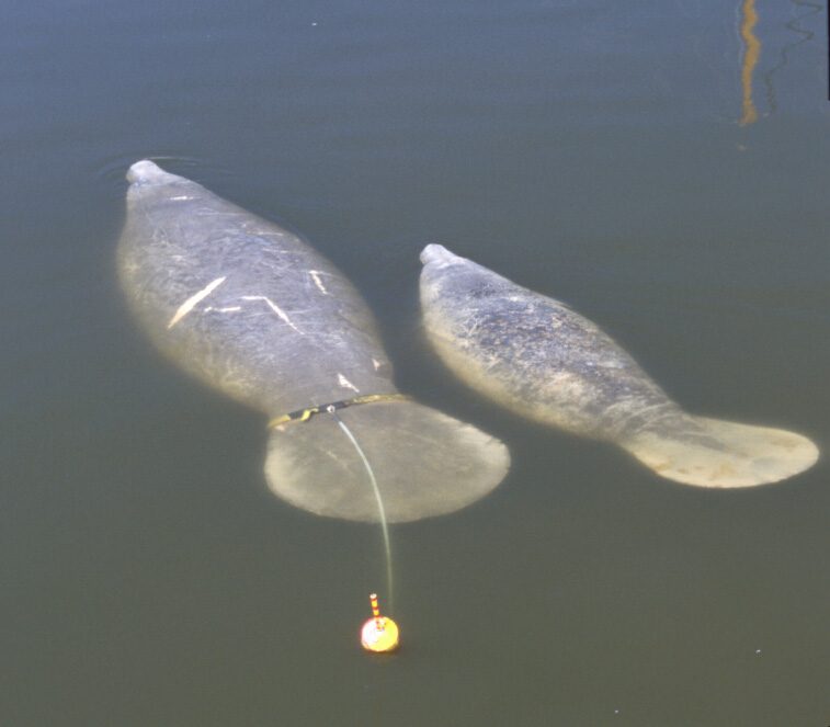
Telemetry
Telemetry research involves
tagging
individual manatees to follow
their
movements and identify habitats
and resources they seek and
need.
Mote
scientists have used telemetry
to examine
behavioral and habitat use
patterns
at a
secondary winter refuge site in
Charlotte
Harbor for the past three winters.
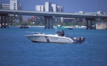
Waterways Management
Many regulations exist to
protect
manatees
from boat traffic. This
research
assesses
compliance with the regulatory
zones and the
overall effectiveness of
enforcement
activities.